iFOREST launches Fire Watch to track the full scale of stubble burning
Multi-satellite dashboard goes beyond fire counts to show when burning peaks and how much farmland is affected
 City Air News
Nov 5, 2026 05:17
0
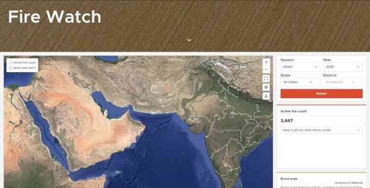
The first phase covers Punjab, Haryana, and other states
Chandigarh, November 5, 2026: Counting farm fires tells only part of the story of stubble burning. Satellites miss fires that are not active when they pass over an area, and the number of fires detected does not show how much agricultural land has actually burned. To bridge these gaps, the International Forum for Environment, Sustainability and Technology (iFOREST) has launched Fire Watch, a multi-satellite dashboard designed to offer a more complete picture of crop residue burning.
Fire Watch tracks three key measures: the number and location of active fires, the time of day when burning is most intense, and the area affected over the burning season. It currently covers Punjab, Haryana, Uttar Pradesh and Madhya Pradesh, with more states planned for the next phase.
“Current monitoring relies on fire counts from polar-orbiting satellites, which give an incomplete picture of stubble burning,” said Dr Chandra Bhushan, CEO of iFOREST. “To design effective interventions, we need to know not only how many fires are detected, but also where and when burning takes place and how much land is affected. Fire Watch brings these data together to make better information available to policymakers and the public.”
How Fire Watch works
Different satellites reveal different parts of the problem.
Polar-orbiting satellites, including MODIS and VIIRS, identify active fires and show their distribution down to the district level. But because they pass over a location only at certain times, they miss many fires.
Geostationary satellites Meteosat 8 and Meteosat 9 carrying the SEVIRI sensor provide observations approximately every 15 minutes, helping identify the hours when burning peaks.
High-resolution Sentinel-2 imagery is then used to compare land conditions before and after the burning season and estimate the total agricultural area burnt. Together, these sources give a fuller picture than fire counts alone.
The Fire Watch dashboard presents this information through interactive maps, charts and filters, making the data accessible to researchers, policymakers and the public. The dashboard will also publish weekly bulletin on stubble burning. The aim is to support better-informed decisions and more targeted action to reduce crop residue burning and its impacts on air pollution and soil health.
Fire Watch was unveiled at a webinar on air quality, agricultural policy and solutions to stubble burning. Participants included Dr Chandra Bhushan; Umendra Dutt, Executive Director, Kheti Virasat; Prof. Sagnik Dey, Head of the Centre for Atmospheric Sciences, IIT Delhi; Nidhi Jamwal, Founding Editor of ON AIR, HEAL and JUGNOO; Mohammad Rafiuddin, Program Lead, CEEW; and Prof. Prabhjyot Sindhu, Assistant Professor, Punjab Agriculture University.