Haryana digitally maps 96 pc villages under Agristack
Haryana has geo‑referenced 1.75 crore agricultural plots and nearly 96 pc of its villages under the AgriStack programme, while more than 11.58 lakh farmers have been enrolled and 8.32 lakh farmer identity documents generated. The remaining villages are expected to be covered within the next two months.
 IANS
Jun 18, 2026 07:19
0
IANS
Jun 18, 2026 07:19
0

Chandigarh, June 18 (IANS) Haryana has geo‑referenced 1.75 crore agricultural plots and nearly 96 pc of its villages under the AgriStack programme, while more than 11.58 lakh farmers have been enrolled and 8.32 lakh farmer identity documents generated. The remaining villages are expected to be covered within the next two months.
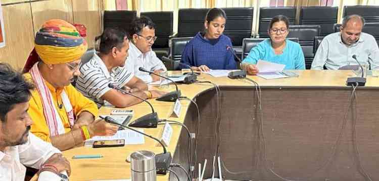
The details were highlighted at a steering committee meeting chaired by Chief Secretary Anurag Rastogi on Thursday. Rastogi said the AgriStack initiative is laying the foundation for a transparent, data‑driven agricultural administration by integrating farmer records, land ownership details, and crop information on a single digital platform. Once fully operational, the system will enable faster delivery of government benefits, reduce duplication and improve targeting of welfare schemes.
During the review, it was revealed that 6,808 of the state’s 7,100 villages have already been geo‑referenced, achieving 95.89 pc coverage. This digital mapping exercise is considered a key prerequisite for the state’s upcoming digital crop survey and the creation of a verified farmer registry.
Financial Commissioner (Revenue) Sumita Misra informed that enrolment under the farmer registry is being accelerated through a network of common service centres across the state. With the centres now actively undertaking registrations, the pace of enrolment is expected to increase substantially in the coming days.
Rastogi directed officers to ensure the expeditious disposal of pending verification cases and to achieve saturation of the farmer registry by linking all land parcels to existing and newly generated farmer identity documents in mission mode.
He also emphasised the need for robust district‑level monitoring to meet timelines and directed officials to conduct regular review meetings to achieve the set targets.
The meeting further reviewed preparations for the Kharif 2026 Digital Crop Survey, which will cover all geo‑referenced plots in 23 districts. About 6,500 surveyors are expected to participate in the exercise, scheduled to commence in August this year.
Officials also informed that nearly 1.75 crore farmer records available in the Revenue Department database will be leveraged to broaden coverage of the farmer registry, including farmers who are not beneficiaries under the PM‑KISAN scheme.
The Chief Secretary said the integration of land records, crop data and farmer databases would help create a reliable digital backbone for agriculture and strengthen evidence‑based decision‑making in the sector.
--IANS
vg/dan