J&K: CS asks DCs to ensure 100 pc AgriStack coverage for eligible farmers
J&K Chief Secretary Atal Dulloo on Friday chaired a comprehensive review meeting to assess the progress of land-record digitisation and implementation of AgriStack across J&K.
 IANS
Oct 2, 2026 11:13
0
IANS
Oct 2, 2026 11:13
0
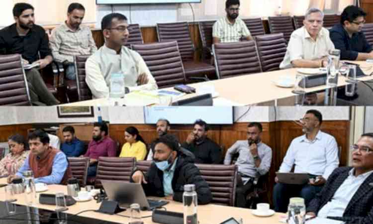
Srinagar, Oct 2 (IANS) J&K Chief Secretary Atal Dulloo on Friday chaired a comprehensive review meeting to assess the progress of land-record digitisation and implementation of AgriStack across J&K.
The meeting focused on district-wise progress in the creation of Farmer IDs, generation of Unique Land Parcel Identification Numbers (ULPINs), digitisation and integration of cadastral maps through BhuNaksha, and the proposed integration of digitised land records with the Reserve Bank of India’s (RBI) Unified Lending Interface (ULI).
Taking a detailed district-wise review of each component, the Chief Secretary sought explanations from Deputy Commissioners regarding delays and gaps between targets and achievements.
He directed district administrations to ensure that no eligible farmer is left out of AgriStack or Farmer ID registration and asked them to furnish certificates to this effect after due verification.
The Chief Secretary also directed Deputy Commissioners to fix responsibility wherever undue delays are observed and conduct frequent field inspections to monitor both progress and quality.
He further instructed them to depute concerned officers for regular field inspections and submit weekly progress reports.
ACS Finance Shailendra Kumar stressed the need to prioritise farmers residing in villages, observing that they constitute the overwhelming majority of the target population, while exceptional cases involving absentees could be taken up subsequently.
He advised against generalising exceptions and urged field agencies to complete AgriStack-related work without further delay.
The ACS Finance also asked Deputy Commissioners to formulate specific operational guidelines for different situations encountered by field functionaries so that procedural issues do not become a reason for delay.
On the occasion, Secretary Revenue Kumar Rajeev Ranjan provided solutions to issues raised by Deputy Commissioners.
He informed the meeting that J&K has achieved 100 per cent digitisation coverage across its foundational land-administration units, covering all 20 districts, 207 tehsils and 6,818 villages.
As many as 68,62,596 land parcels (Khasras) have been digitised.
The backlog of 6,47,274 mutations has also been incorporated across all 20 districts, leaving no pending backlog.
The meeting was informed that the department received 14,48,748 grievances, of which 14,38,571 were non-quasi-judicial.
As many as 14,27,576 non-quasi-judicial grievances have been resolved.
Against a base of 71,04,737 Khasras across 6,818 villages, data entry for AgriStack has progressed substantially, with 65,77,944 Khasras submitted, 58,17,502 verified and 57,30,681 approved, representing 80.7 per cent of the total base.
In Jammu Division, 2,770 out of 3,750 villages have been fully approved, with an overall Khasra approval rate of 80.8 per cent.
Similarly, in Kashmir Division, 1,945 out of 3,068 villages have been fully approved, with an overall Khasra approval rate of 80.5 per cent.
The meeting was informed that 1,21,472 Farmer IDs have been generated across 1,663 villages so far.
Kashmir Division accounts for 70,979 Farmer IDs across 836 villages, while Jammu Division has generated 52,751 Farmer IDs across 827 villages.
Regarding the Digital Crop Survey, it was informed that the Kharif 2026 survey is being undertaken across 5,714 villages covering around 30.61 lakh agricultural plots.
The survey has been completed for 30,61,696 plots, representing 96.55 per cent progress, while supervisors have approved 27,27,189 plots.
As far as ULPIN generation is concerned, the meeting was informed that significant progress has been recorded.
As of September 25, ULPIN coverage had expanded to 5,275 villages from 4,078, while the number of ULPINs generated increased to 33,47,011, registering an addition of 4,08,887 since the previous review.
The meeting also reviewed the implementation of BhuNaksha and the integration of cadastral maps with digitised land records.
Under the prescribed six-step workflow, the process involves inventory and collection of Shajra/Mussavi maps, geo-referencing, Khasra-wise subdivision into daughter maps, topology and boundary checks, integration with Jamabandi/Record of Rights (RoR), and field validation by Patwaris.
Out of 6,818 village maps, 6,468 have been handed over to BISAG-N, of which 6,049 have been received back.
Geo-referencing of 425 maps is pending, while attribute tables for 5,754 maps have been completed.
The meeting was also apprised of the proposed integration of J&K’s digitised land records with RBI’s Unified Lending Interface through specialised APIs.
The integration is expected to facilitate secure access to relevant land and farm-related information for agricultural lending, including landowner and land-parcel details, farm parameters, mortgage details, crop information and flagging of existing loans.
The Chief Secretary directed all concerned agencies to work within fixed timelines and clearly assigned responsibilities.
Deputy Commissioners have been asked to complete the locking of RoR/Jamabandi within one month of Farmer ID generation, complete Farmer ID generation in all identified villages, and address unclaimed buckets and cross-district land parcels within two months.
The Chief Secretary stressed that the digitisation exercise should not remain confined to data generation but must translate into accurate, updated and field-validated land records that enable faster citizen services, transparent land administration and easier access to institutional agricultural credit for farmers.
--IANS
sq/dan